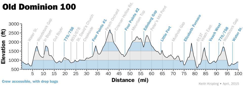
Course Information

Some rocks, some mud, lots of sun and a few miles

Old Dominion 100 Course

The course features 14,000 feet of gain over a multitude of surfaces. The course is roughly made of 62% dirt & gravel roads; 22% trails & single track; 16% paved roads. Runners will find themselves bouncing between all the different terrain throughout the day. During the day the course is marked with trail ribbon. Double ribbons at turns. While at night, the trail is marked with Chem lights (glow sticks).

We offer 24 aid stations, most spaning 4-6 miles between each. Aid Stations are filled with standard aid station fare of sandwiches, fruits, chocolate, ice, water, electrolyte drink, chips and cookies. Some stations may have more with burgers, pancakes, grilled cheese, etc.

Weather plays a huge role in what you will see. We've had very dry and exposed years, while others have been mud filled. Usually there are plenty of horse flies to go around. What will be in store for this year?
Aid Stations
# Name Total Mileage Mileage to Next Notes
firstsix

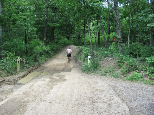
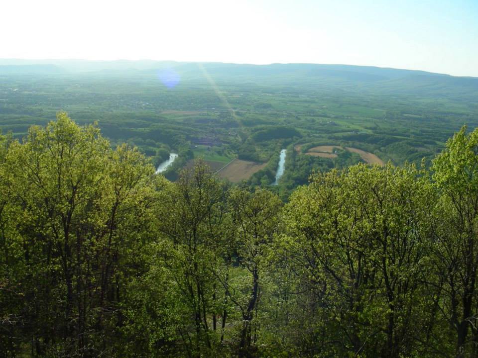
The first six miles of the course travels through historic Woodstock. Here, the fighting minister, Peter Muhlenberg preached his sermon then removed his robe to reveal the Revoluntionary uniform and led his fellow townmen out to win liberty, saying “there is a time to pray and a time to fight.” Reaching the Shenandoah River at Burnshire Dam, the course crosses by bridge, approaches its first major ascent to Woodstock Gap on a steep GRAVEL switchback and enters the George Washington National Forest. Descending into Fort Valley’s natural fortress, created by the encircling Massanutten Mountains, is more gradual until approx. 10 mi. upon reaching the fairly RUGGED 2.5 mi. Lavender TRAIL up and along the West ridgeline, then down to a GRAVEL Forest Service road winding into the Foley Loop on country roads.

woodstocktower

The good country ROADS give way to Four Points #1 at approximately 32.5. Leaving Four Points leads to the TRAIL climb up to the 675 Overlook and continuing down on PAVEMENT. Here the course quickly enters Duncan Hollow on TRAIL that exacts the “just do it” attitude, as it's the tallest elevation of the day and is usually accompanied with mid-day sun and horse flies for the masses. But does lead to good footing for five miles onto Crisman Hollow with GRAVEL road back to Four Points #2. The course turns to climb Moreland Gap, reaching Edinburg Gap at 55 miles.

elevation
50miles

You enter Powell Mountain TRAIL. The next eight miles have become a heavily utilitized ATV route. Ascending Opechee Peak the TRAIL becomes rugged and steep. The last half, still rugged is not so steep. Reaching Little Fort Campground the course turns up Woodstock Mountain on GRAVEL forest road for five miles to Mudhole Gap. The next mile is TRAIL as lovely as any you will ever visit, running with Little Passage Creek and through it five times. The course turns onto a fine LOGGING ROAD leading to a turn onto a short, rocky, TRAIL, then crossing the Valley Road, Passage Creek by bridge and into Elizabeth Furance Picnic Area, the second and final Medical Check at 74.95 miles. This is the only point with a cut-off time. Runners must check-out of Elizabeth Furance by midnight.

last 26 miles

The next three TRAIL miles are best summed up in the phrase “Sherman Gap”. Rumor has it that the gap was not named for any great explorer but rather for the first (and possibly the last) endurance race runner to try to run up it. Runners are greeted with a steep TRAIL run down to a GRAVEL road, leading to the wagon road, built by Gen. Daniel Morgan during the Revolutionary War, up Veach Gap and down the boulder falls on the west side. Because most runners will traverse in darkness the difficult stretch from Elizabeth Furnace to the Aid-Station located at the foot of the Veach Gap descent, this is the only part of the race where the runner, if they so chooses, may be accompanied by a safety runner. Crossing the Valley road the course now has good footing on country ROADS to complete the circle around the Massanuttens, then back up and over Woodstock Mountain and through town to the finish.

Course Documents


To learn more about the course please review the Redbook. Or use these resources.

Printable Runner's Turn Directions

Printable Pit Crew's Directions